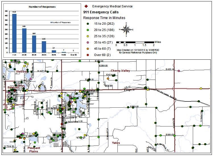
*In 2015, Lake County was considering the need for additional emergency response service vehicles, stations, and staff. Lake County wanted to know what their current response times were for calls coming from the outer townships and if there were any gaps or areas where the response times were longer, or if response times across the county were fairly standardized. The county provided WMSRDC’s GIS Department with 911 response data, addresses from which calls were placed, and the time lapsed between the call and when responders arrived on scene. WMSRDC inputted the addresses and the time data associated to each call. With this information, WMSRDC mapped the time lapsed for each call and therefore could potentially identify any need for additional services.
Lake County 911 Response Time Study
Share: