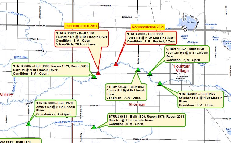
In 2016, the Mason County Road Commission was searching for a way to display ratings and post information on the county’s bridges. They wanted a way to not only track bridge maintenance needs but a document to share with local emergency services, farmers, industrial businesses, and other members of the public who rely on the use of local bridges and roads for safe passage. Using the Michigan Department of Transportation’s (MDOT) Asset Management ratings of local bridges and notes from the Mason County Road Commission, WMSRDC created a map. The map create shows not only the bridge locations but critical information and any restrictions that may exist to inhibit the use of the bridges for specific uses and to keep track of bridge reconstruction projects. The map is posted on the Mason County Road Commission’s website and has been updated every two years or so. You can view the Mason County Bridge Map Here.
The Bridges of Mason County
Share: