Plan Writing
Few local governments in the WMSRDC region have paid planning staff, and many communities lack resources necessary to hire a private consultant. Such conditions can inhibit local ability to maintain planning documents, whether required or desired. Although writing plans, such as master and recreation plans, constitutes a fraction of the overall WMSRDC work program and budget, this service is central to our mission of supporting and coordinating planning functions of local governments.
As a policy, WMSRDC does not wish to compete with private consultants, and therefore, does not respond to requests for proposals issued by local governments. We are careful to only provide this service when local communities cannot afford to, or choose not to, enlist services from the private sector.
GIS & Mapping
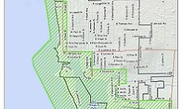
A Geographic Information System (GIS) is a powerful computer system that enables visualization, analysis, and communication of large quantities of spatial data (i.e., data displayed on a map). GIS is an essential planning tool for WMSRDC, supporting various program areas and aiding community development within the region. This service is offered to local governments and community organizations at cost, and includes creating new maps, digitizing old maps, and developing spatial solution applications for planning and management purposes.


